OroraTech: Empowering America's Wildfire Response
With our satellite-powered early detection and wildfire management platform, OroraTech is poised to fulfill the needs of President Trump’s federal wildfire reform. We stand ready to provide our wildfire intelligence with data sharing capability, innovative modeling & mapping capabilities, and satellite technology to identify wildland fire ignitions.
Executive summary
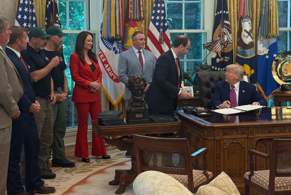
In response to the devastating January 2025 Los Angeles wildfires, this Executive Order on "Empowering Common Sense Wildfire Prevention and Response" directs federal agencies to streamline wildfire governance, support local preparedness, and modernize response efforts. It mandates consolidation of federal fire programs, promotes partnerships with state and tribal entities, and calls for the development of advanced technology tools like AI-based modeling and ignition detection. The order seeks to eliminate regulatory barriers to prescribed burns and fire retardant use, encourages innovative biomass utilization, and improves utility practices to prevent fire ignitions. It also pushes for public release of satellite data, new wildfire performance metrics, and repurposing of excess military aircraft - all aimed at enabling faster, smarter, and more coordinated wildfire prevention and response.
From space to earth - delivering the order’s vision
We directly address the Executive Order on Empowering Commonsense Wildfire Prevention and Response by delivering satellite-based wildfire intelligence that enhances early detection, risk modeling, and operational coordination. Our technology contributes to the development of a comprehensive technology roadmap through AI-powered fire spread prediction, ignition detection, and real-time mapping. We facilitate risk-informed decision-making by integrating geospatial data and modeling tools that support proactive mitigation strategies. Through these capabilities, we empower state, local, and federal stakeholders to act faster, smarter, and more collaboratively in preventing and responding to wildfires.
Develop a Comprehensive Technology Roadmap
We contribute cutting-edge tools such as AI-based fire spread modeling, ignition detection, and real-time mapping, helping federal and local agencies build the technology roadmap mandated by the order. Our capabilities directly enhance response speed, accuracy, and strategic planning.
Promote the Use of a Risk-Informed Approach
Our risk analysis tools simulate fire scenarios and identify vulnerable zones, enabling smarter land and response planning. This supports the order’s call for policies that use risk-based decision-making to improve year-round wildfire readiness.
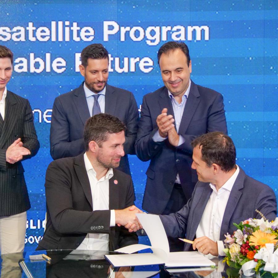
Expand and Strengthen the Use of Partnerships, Agreements, Compacts, and Mutual Aid Capabilities
We actively collaborate with federal, state, tribal, and local partners by integrating data services and supporting land management coordination. This empowers the network of responders envisioned in the Executive Order.
Improve Coordination During Wildfire Response
We provide live satellite data, situation updates, and fire perimeter mapping to response agencies in near real-time. These services support multi-agency coordination on the ground, improving shared situational awareness and operational decisions.
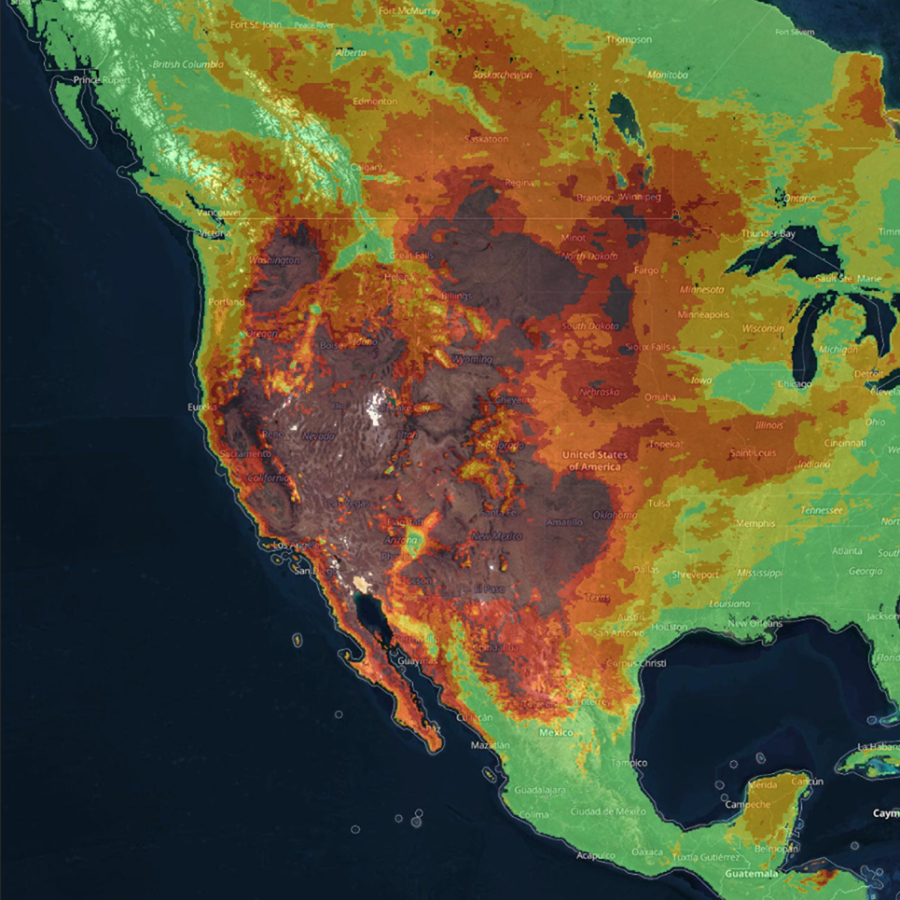
Identify and Make Publicly Available Historical Satellite Datasets
Our analytics help measure response time, fuel treatment effectiveness, and cost efficiency by tracking fire events and operational outcomes. These insights feed directly into the performance metrics required by the order.
Increase Wildfire Firefighting Capabilities at the State and Local Levels
We deliver real-time satellite-based wildfire intelligence directly to state and local teams, helping augment their awareness, planning, and rapid response capacity. This directly contributes to strengthening frontline capabilities as outlined in the order.
Comprehensive wildfire management for the federal government
OroraTech supports decision-makers at every stage of wildfire management – before, during, and after – providing the critical fire intelligence needed to plan actions and protect what matters most.
Risk assessment
Predict the fire risk and assess the local weather and vegetation conditions.
- Fire Weather index: Access a 9-day forecast and detailed mapping of the fire risk.
- Weather information: Stay informed about critical factors including wind speed and direction, temperature, lightning strikes, and humidity.
- Vegetation & terrain analysis: Assess conditions using land cover, vegetation indices, and 3D maps.
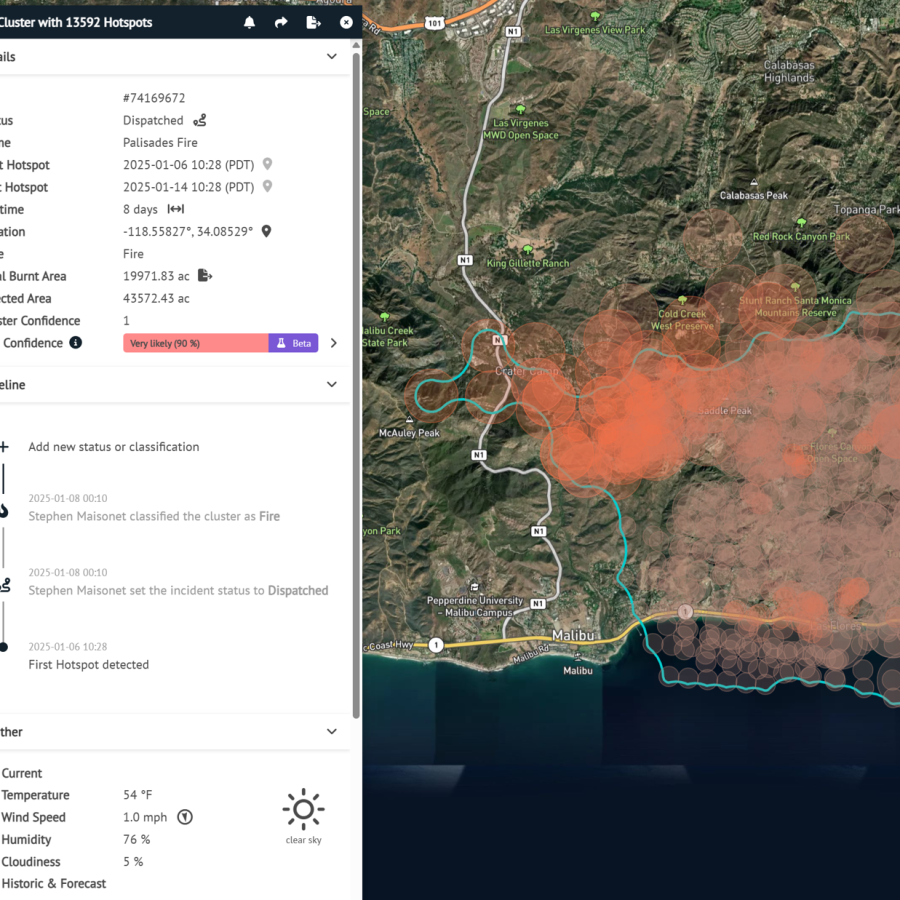
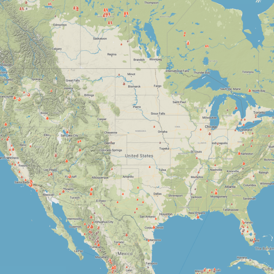
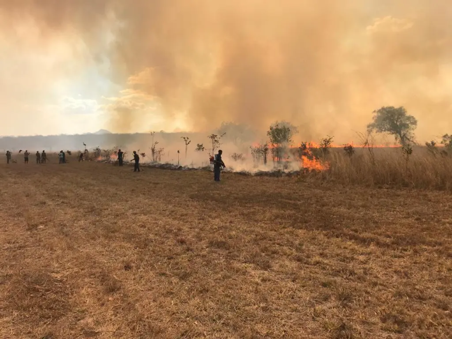
Early detection
Receive instant alerts of active wildfires via different notification methods.
- Data from over 40 satellites: Get precise detection and capture fires as small as 10x10 meters.
- Automatic notifications: Receive instant email, WhatsApp messages, SMS, or in-app alerts within minutes of any new fire detections in your monitored areas.
- Accurate location & fire area: Get precise location coordinates, data on fire intensity, and estimates of the affected area.
- Fire confidence: Evaluate multiple factors to confirm if a heat anomaly is a genuine fire, reducing false alarms and enabling timely, cost-effective decisions.
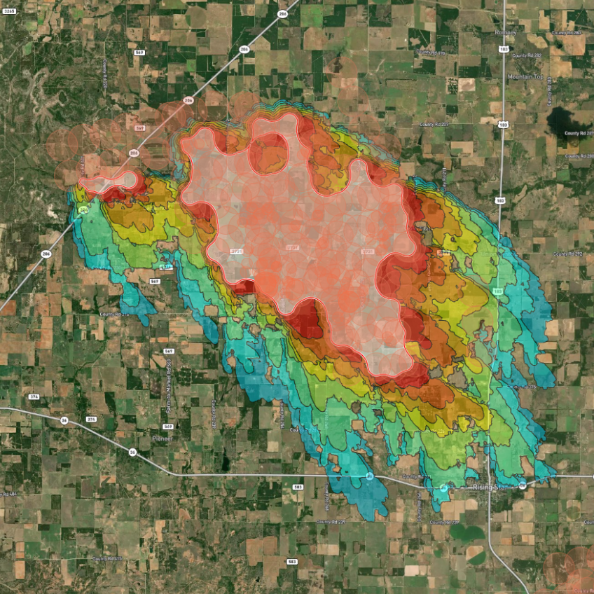
Near-real-time monitoring
- Continuous fire tracking: Monitor the active fire front and its development with regular updates.
- Fire spread simulation: Benefit from our analysis of crucial fire drivers such as weather, topography, and fuel to estimate the potential fire spread.
- Situational awareness: Stay informed with our customizable Incident Overview, displaying only the data you need for effective decision-making.
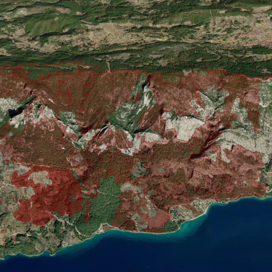
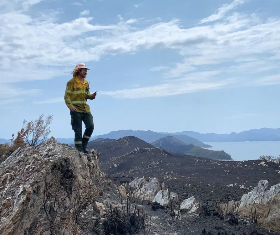
Post-fire impact analysis
Quantify burnt area automatically and estimate losses.
- Burnt area: Utilize advanced technology for high-resolution mapping of burnt areas and severity assessment.
- Fire statistics: Uncover patterns and trends in wildfire activity using our comprehensive historical dataset, automatic dashboards, and visualizations.
- Fire origin & evolution: Observe fire progression over time.
Deep experience with state and federal agencies worldwide
Canada - SOPFEU Quebec
“After a first year of working with OroraTech during the 2021 fire season, we have seen that their services have increased our potential for early detection of new wildland fires. We also used their platform to monitor the progression of fires in situations where traditional sources of information are limited, nocturnal progression for example.”

Mathieu P.
OroraTech & SOPFEU Working Together to Protect the Unique Forests of Quebec from Wildfires
US Forest Service - Niassa National Reserve
"The Niassa Special Reserve in northern Mozambique faces a huge problem of forest fires that every year cause environmental, social, and economic damages. Thanks to OroraTech's WFS we are able to monitor the wildfires as well as gather the information needed to analyze their spatio-temporal pattern which is a very important component for the designing of an integrated fire management plan to address this problem within this conservation area."

Leonel M.
On a Mission To Save the Niassa Special Reserve: Home of the Last Great Elephant Population
Tasmania Parks & Wildlife Service
"We were seeking a platform that could help us detect bushfires early. We have found OroraTech to be a great fit for our needs and it is aligned with our organization's mantra of - early detection and rapid response. While others provide satellite data, what sets OroraTech apart is its start-up culture, excellent customer liaison team, and commitment to meeting our needs. Members of the OroraTech team listen to our needs and are consistently improving the platform, we look forward to future developments and enhancements!”

Richard D.
OroraTech & Tasmania Parks and Wildlife Service: Preserving Tasmania's Ecological and Cultural Heritage with Remote Sensing
Ready to align with federal priorities? So are we.
From early detection to post-fire analysis, turn data into action and get insights the US federal government needs to make informed decisions and safeguard your operations. Speak to an expert today to see how OroraTech can support Executive Order 13855.