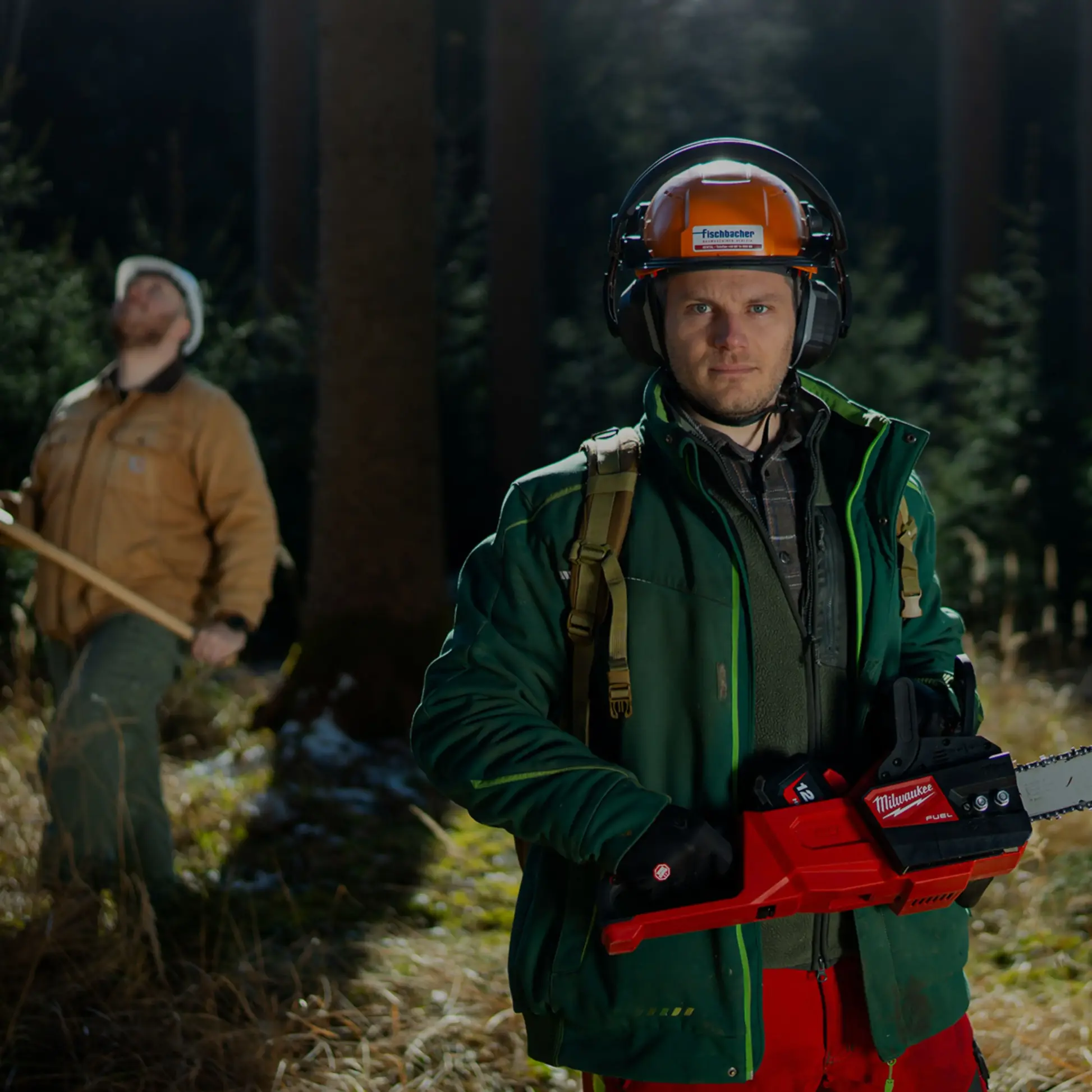
Protecting America’s forests from wildfire
Safeguarding the nation’s forests – whether public, private, or tribal lands – requires proactive fire management. We provide near-real-time monitoring, early detection, and rapid alerts, helping land managers, foresters, and fire agencies respond swiftly to emerging threats and protect vital ecosystems, timber resources, and wildlife habitats.
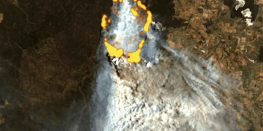
Wildfires: a growing threat to our forests
Wildfires are increasingly jeopardizing American forests, causing irreversible damage to ecosystems and threatening biodiversity. Traditional tools cannot keep pace, making it harder for forest and land managers to respond with the speed and precision needed.

Record-breaking economic losses
The 2025 LA wildfires alone are estimated to have more than $250 billion in economic losses, making them one of the costliest natural disasters.

Environmental devastation
In 2025, wildfires have already burned more than 707,000 acres across the U.S., destroying habitats and leaving long-term ecological scars.

Increasing fire frequency
Extreme wildfires in the U.S. are projected to increase by 14% by 2030 and by 30% by 2050.
How we make a difference
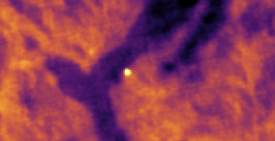
See through smoke, anytime, anywhere
Detect wildfires even in remote areas and under challenging conditions, with 24/7 global coverage.
React instantly with precise insights
Access accurate fire location and intensity data to ensure a faster and more effective response.
Secure full situational awareness & control
Understand fire dynamics, including potential spread, severity, and losses, for confident decision-making.
Comprehensive wildfire solutions for forestry
Our tools are designed to support every stage of the wildfire cycle – from early detection and fire spread modeling to near-real-time monitoring and post-fire assessment. Built for U.S. forestry professionals, these solutions provide critical intelligence to protect forest assets and improve response efficiency.
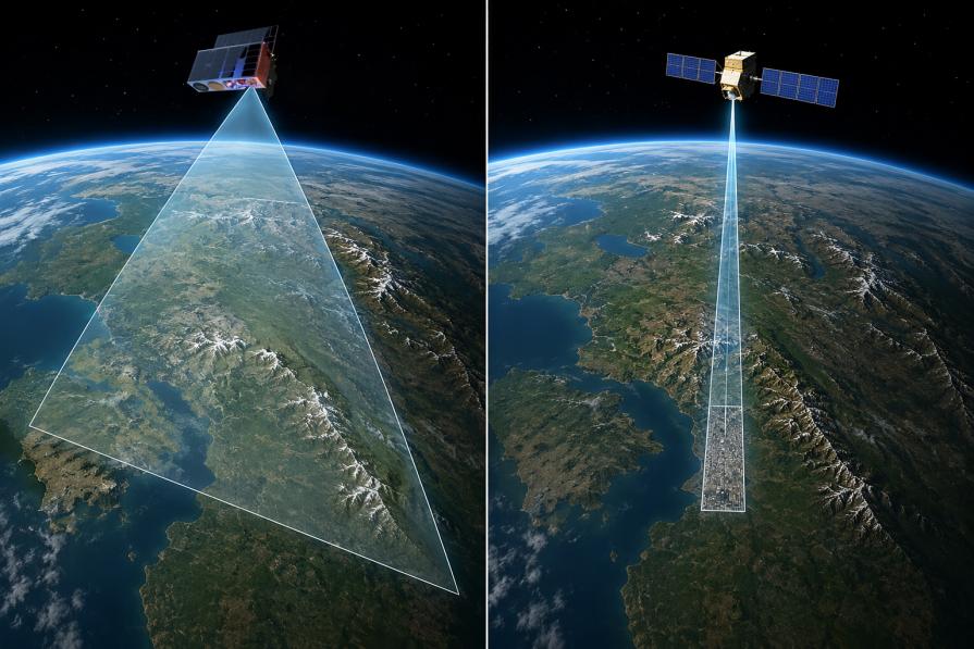
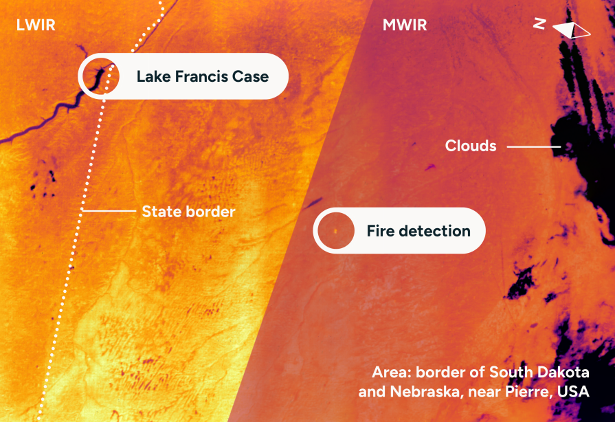
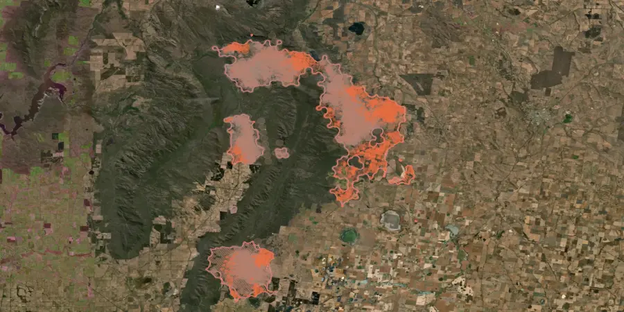
Detect and monitor wildfires in near-real-time
The first global wildfire intelligence solution providing risk assessment, early detection, near-real-time monitoring, and damage analysis using data from 25+ satellites. With AI-powered detection and continuous coverage, it delivers fast alerts, tracks fire progression 24/7, and provides precise insights on location, perimeter, and intensity to support rapid response.
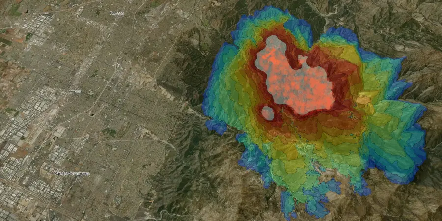
Model wildfire behavior to optimize your response
OroraTech’s Fire Spread provides wildfire growth modeling for instant decision-making. With time-stepped visualizations, it predicts fire direction, speed, and size, enabling proactive response planning. Simulate fire progression over the next 24 hours, adjust parameters to real-world conditions, and prioritize resources to protect the most vulnerable areas.
Assess fire impact and plan restoration
OroraTech’s Burnt Area delivers high-resolution burn scar mapping every 2–3 days using before-and-after satellite imagery. Quickly assess the extent and severity of fire damage to guide recovery efforts. With detailed fire scar detection, burn severity analysis, and fast post-fire data, it supports effective restoration planning.
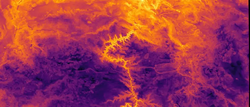
Advanced thermal mapping for precision monitoring
Coming soon: OroraTech’s Land Surface Temperature provides continuous thermal data to track environmental conditions and detect heat trends across forests. Monitor land surface temperature variations, analyze historical and real-time trends to identify thermal anomalies, and enhance situational awareness.
Why choose our solutions

Comprehensive satellite network
Data from 25+ satellites for unparalleled coverage and detection capabilities.

Proprietary algorithms
Cutting-edge fire detection algorithms ensure reliability and robustness.

Comprehensive data set
Four years of wildfire history for advanced analysis and decision-making.

Actionable insights
Cluster hotspot detections for better fire front visualization and confidence levels.

Incident management
Classify heat anomalies to distinguish wildfires from industrial heat sources.

User-friendly interface
No hardware or maintenance costs, with an easy setup for immediate use.
Take action to protect your forests
Protect public and private forests with continuous fire risk assessment, early detection, and post-fire impact analysis to support sustainable land stewardship.