Stay twenty-four steps ahead of wildland fire
Get quick, advanced predictions on where a fire will move. In-depth and summarized data helps you position your responders exactly where you need them to go.
Stay twenty-four steps ahead of wildland fire
Get quick, advanced predictions on where a fire will move. In-depth and summarized data helps you position your responders exactly where you need them to go.
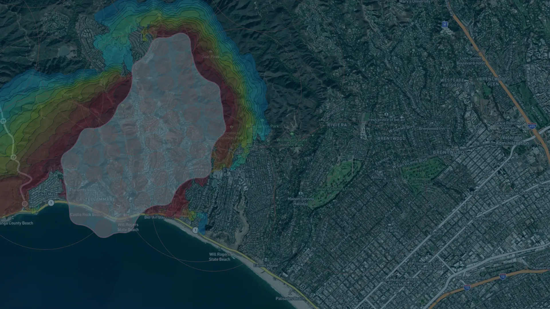
Swift fire spread simulations for faster decisions
Get fast fire spread predictions based on real-world conditions. Using wind, vegetation, and elevation – plus customizable inputs – Fire Spread delivers results in seconds.
Like all spread models, our algorithm does not factor in suppression efforts. Upload or draw your fire line to see suppression effects and predict spot fires or breakouts.
Predict the path of the fire in seconds

Fast, informed fire spread predictions
Support timely decisions by knowing where the fire will move next. Calculate real-time simulations at the click of a button, with most spreads ready in under a minute.

Enhanced condition customization
Run scenario-specific simulations and adapt predictions to local conditions by adjusting parameters like wind speed, direction, and fuel moisture.

Seamless and smart collaboration
Save and share multiple simulations per fire cluster to compare outcomes and coordinate effectively with teams. Export results in GeoJSON or KML formats, or share via links.

Comprehensive data integration
Leverage global datasets like Copernicus DEM for elevation and LandFire Fuel Map to account for U.S.-specific, regional fuels.

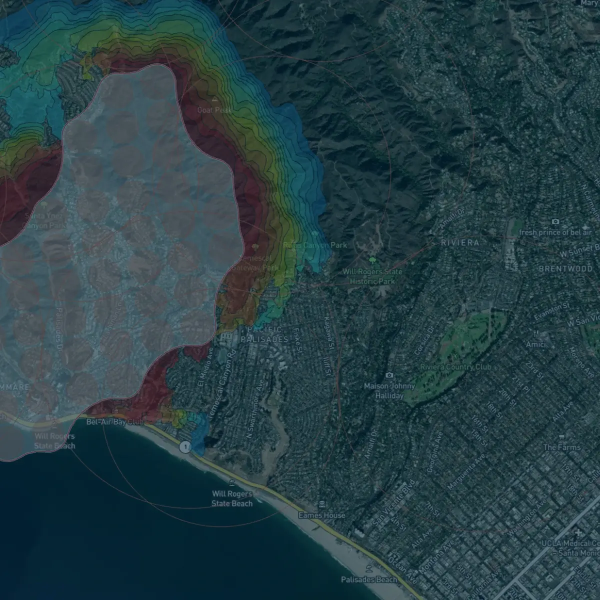
Time-stepped visualizations
Improve situational awareness with clear, step-by-step animations showing fire spread over the next 24 hours, supporting more confident decision-making.

Flexible integration options
Use within OroraTech’s Wildfire Solution or integrate via API into your own systems, ensuring a tailored wildfire management approach.
What our customers are saying
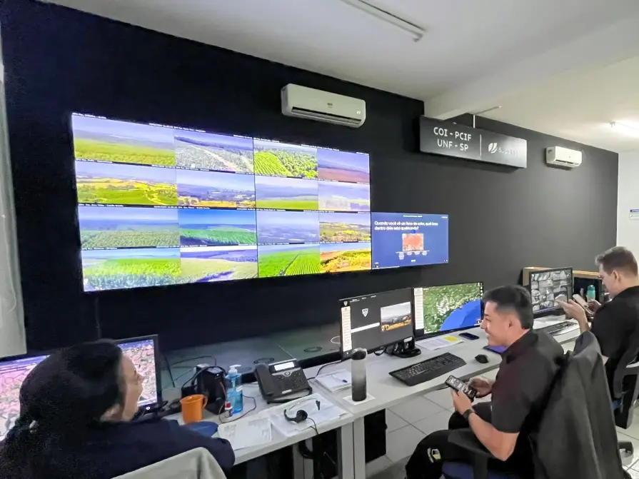
Suzano
"By leveraging advanced mathematical modeling, we’ve revolutionized how we approach wildfire prevention. These models integrate critical data like wind speed, terrain, and biomass to predict fire impacts hours or days ahead, enabling strategic firefighting. Working alongside partners like OroraTech, we’ve protected millions of hectares and improved field team safety while advancing wildfire prevention worldwide."

Douglas O., Head of Security
A Matter of Scale: How OroraTech's Wildfire Solution Protects Suzano Forests
SOPFEU Quebec
"We map fires from space when other methods are not possible. OroraTech's Wildfire Solution is an operational mindshift. We never had success with the satellite based data before. In 2023, OroraTech became the main information source for fire detection and monitoring to maintain situational awareness."

Mathieu P., Director of Aviation Services
OroraTech & SOPFEU Working Together to Protect the Unique Forests of Quebec from Wildfires
Your frontline defense against wildfire threats
Our experts are here to help you leverage OroraTech’s Fire Spread solution for faster, more accurate wildfire predictions tailored to your specific needs. Contact us for a personalized demo and see how our solution can empower you to act confidently and minimize wildfire risks.
Frequently asked questions
How do I access and run the fire spread model?
You can access the Fire Spread model in two ways:
- Via the Wildfire Solution platform: Run simulations for existing fire clusters or custom shapes by selecting a cluster or uploading a valid GeoJSON file.
- Via the Wildfire Solution API: Use the API to programmatically run fire spread simulations and integrate the results into GIS tools or operational workflows.
What data is used for the fire spread simulation?
The Fire Spread model integrates multiple data sources for precise wildfire spread predictions:
- Current Fire Data: The model relies on real-time OroraTech Aggregated Active Fire data for accurate simulations.
- Elevation Data: Incorporates global elevation datasets like Copernicus DEM with 30m resolution, allowing for detailed modeling of how terrain impacts fire behavior.
- Fuel Maps: Utilizes the LandFire map for the U.S. to incorporate local and regional fuel specificities.
- Wind Data: Leverages high-resolution wind forecasts from global weather models, with an option to use WindNinja for more localized wind simulations.
Can the model be integrated with other systems or software?
Yes, our fire spread model outputs results in GeoJSON and KML formats, which are compatible with most GIS platforms like ArcGIS and QGIS. This allows for easy integration into existing workflows, making it simple to visualize and analyze fire predictions alongside other spatial data.
Is it possible to customize the simulation?
Yes, Fire Spread offers robust customization options to tailor simulations to your specific needs:
- Adjustable weather parameters: Modify wind speed, direction, and fuel moisture content up to 24 hours in advance.
- Custom weather models: Fire Spread automatically selects the highest-resolution regional wind model for your simulation. In the US, this typically defaults to the GFS HRRR model. However, you can manually switch to alternative weather models for custom regional accuracy.
- Scenario variations: Create multiple simulations for the same fire cluster, adjusting parameters to explore different outcomes.
- WindNinja integration: Include localized, high-resolution wind analysis in your simulations for more precise predictions in areas with complex terrain.
Can I export and share the Fire Spread simulation results?
Yes, the Fire Spread tool supports multiple export and sharing options for collaboration and operational efficiency:
- Data exports: Results can be exported in GeoJSON and KML formats, that are compatible with GIS and visualization platforms.
- Bulk exporting: Share multiple simulation results for a single fire cluster at once, streamlining communication and analysis.
- Shareable links: Generate links to quickly share simulation results with team members, stakeholders, or partners.
Your question is not here?
Explore the latest in wildfire management
Beyond early detection: How Arkansas Forestry is using space-based tech for innovative wildfire management
Arkansas Forestry Division Raises Bar of Fire Tech, Completing OroraTech Trial