Incident Detection & Mapping
Spot, monitor, and manage fires in one collaborative tool.
Incident Detection & Mapping
Spot, monitor, and manage fires in one collaborative tool.
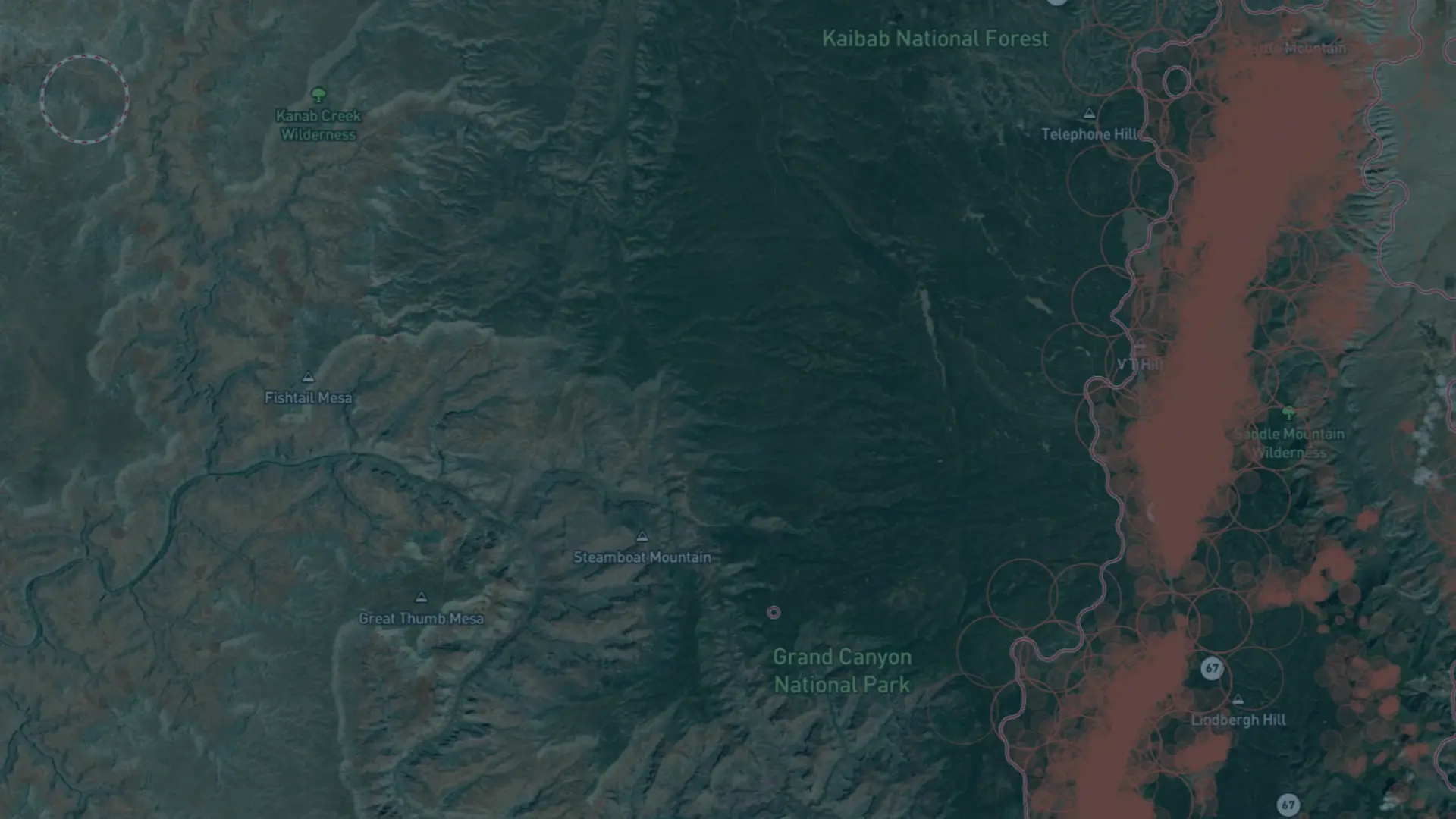
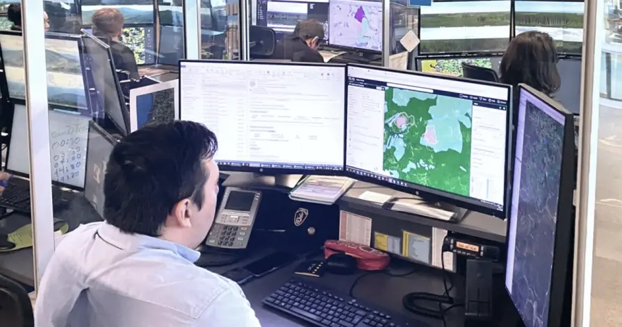
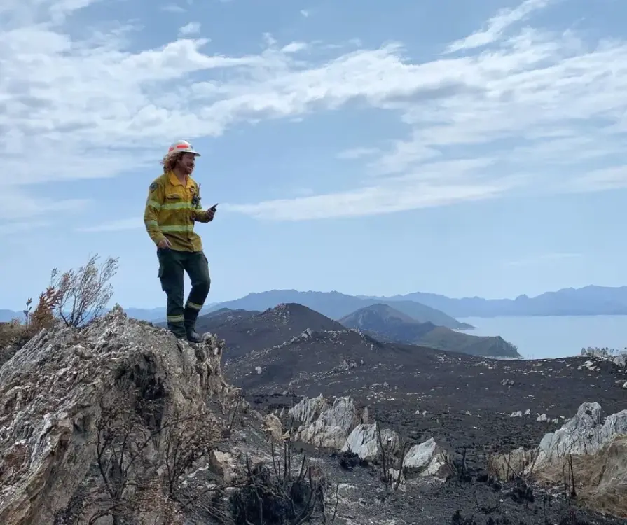
Build situational awareness during incidents
Employ a complete toolkit to manage every wildland fire in your territory. We offer deep, responsive data so you can answer questions with a few clicks.

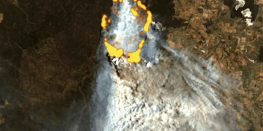
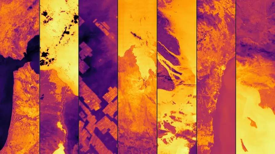
See through smoke, anytime, anywhere
Detect fires in remote areas and under challenging conditions with 24/7 global satellite coverage.

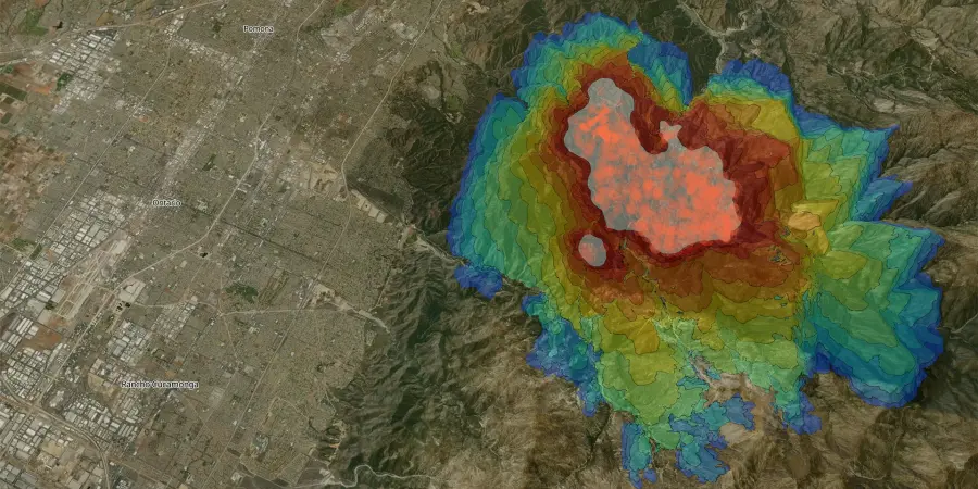
React instantly with precise insights
Access fire location, dynamics, and intensity data to ensure a faster and more effective response.

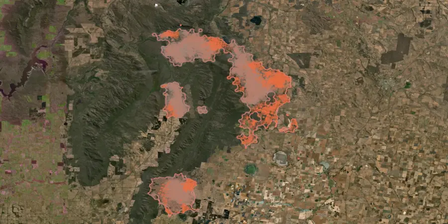
Build a single stream of integrated data
Seamlessly integrate wildfire intelligence to your current platform via API or bring other sources into our Wildfire Solution platform.
Visibility before, during, and after an incident
Whether you are managing a prescribed burn or a wildfire, we help you incorporate everything from fuel assessments to damage analysis so you never have to fight blind.
Risk assessment
Prepare for wildland fires with advanced risk assessment tools to enhance prevention and preparedness.
Fire Weather index: Access a 9-day fire risk forecast with detailed mapping to anticipate potential wildfire threats.
Weather information: Monitor key wildfire-driving factors such as wind speed and direction, temperature, lightning strikes, and humidity.
Fuel & terrain analysis: Evaluate fire conditions with land cover assessments, vegetation indices, and official sources like WFIGS.
Early detection
Act fast with near-real-time alerts and data to support immediate response efforts.
Satellite-powered detection: Monitor wildfires with data from 35+ satellites, including OroraTech's first-of-its-kind wildfire constellation.
Instant alerts: Receive customizable automatic notifications via email, text, WhatsApp, or in-app alerts within minutes of a fire detection in your monitored areas.
Precise fire location & size: Access exact coordinates, fire intensity data, and estimates of the affected area for better situational awareness.
Fire confidence analysis: Reduce false alarms with our transparent analysis to confirm whether a heat detection is a genuine fire.
Near-real-time monitoring
Continuous fire tracking: Monitor from the heel to the head with regular updates and clearly scheduled overpasses.
Situational awareness: Build an incident dashboard that works for you, displaying only the data you need for effective decision-making.
Integrated incidents: Combine your external sources like cameras, drones, and IoT sensors with our platform to create a holistic view of fire events and streamline decision-making.
Impact analysis
Gain critical insights into wildfire impacts and origins to enhance recovery, prevention, and legal preparedness.
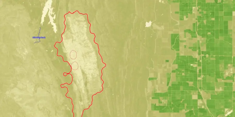
Burned area: Utilize advanced technology for high-resolution mapping of burned areas and severity assessment.
Fire origin & evolution: Replay fire progression for analysis and strategic feedback.
Liability reduction: Document wildfire conditions, assess compliance with regulations, answer press questions, and provide evidence for legal and insurance claims.
Empowering you throughout all phases of fire management
Beyond the smoke
Detect and monitor active fires even under challenging conditions.
Fire Spread
Predict fire propagation to guide effective response strategies.
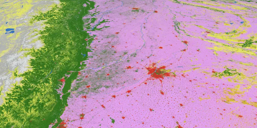
Fire clusters
Identify and analyze fire perimeter for proactive planning.
Land cover
Gain insights into terrain and vegetation distribution.
Vegetation damage
Understand the condition of vegetation in fire-prone areas.
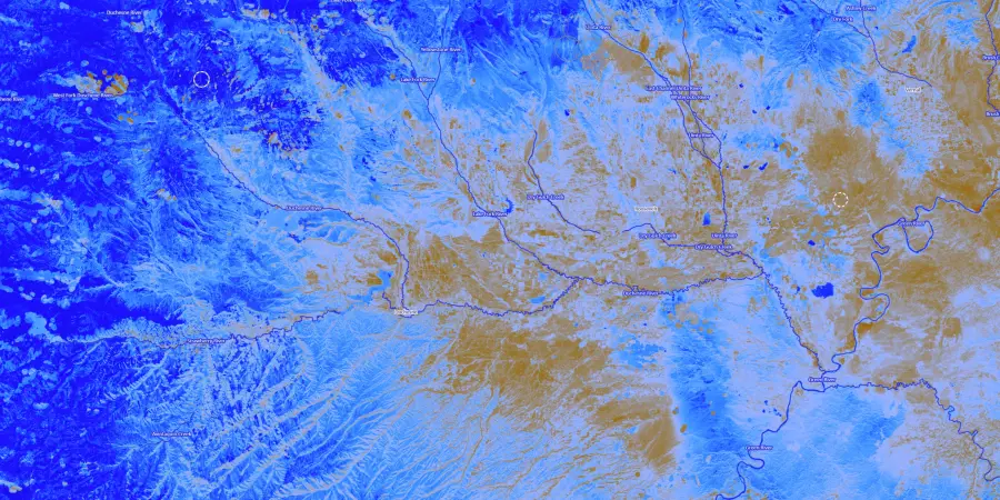
Fuel moisture data
Assess the flammability of vegetation for better risk prediction.
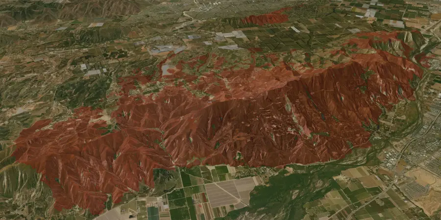
Burnt area
Quantify fire-affected regions for damage assessment.
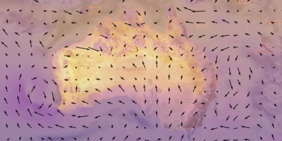
Critical weather factors
Analyze temperature, humidity, and wind speed influencing fire behavior.
Trusted by industry leaders across the globe

ARAUCO Chile
“OroraTech’s data and team support enabled our team to concentrate on the crucial task of combating the fires, especially at night when visibility and aircraft resources are scarce for having an overall overview of the situation.”

German N., Head of Forest Fire Protection
OroraTech & ARAUCO: Battling Devastating Fires in Chile
US Forest Service - Niassa National Reserve
"The Niassa Special Reserve in northern Mozambique faces a huge problem of forest fires that every year cause environmental, social, and economic damages. Thanks to OroraTech's WFS we are able to monitor the wildfires as well as gather the information needed to analyze their spatio-temporal pattern which is a very important component for the designing of an integrated fire management plan to address this problem within this conservation area."

Leonel M., Field Specialist
On a Mission To Save the Niassa Special Reserve: Home of the Last Great Elephant Population
SOPFEU Quebec
"We map fires from space when other methods are not possible. OroraTech's Wildfire Solution is an operational mindshift. We never had success with the satellite based data before. In 2023, OroraTech became the main information source for fire detection and monitoring to maintain situational awareness."

Mathieu P., Director of Aviation Services
OroraTech & SOPFEU Working Together to Protect the Unique Forests of Quebec from Wildfires
Tasmania Parks & Wildlife Service
"We were seeking a platform that could help us detect bushfires early. We have found OroraTech to be a great fit for our needs and it is aligned with our organization's mantra of - early detection and rapid response. While others provide satellite data, what sets OroraTech apart is its start-up culture, excellent customer liaison team, and commitment to meeting our needs. Members of the OroraTech team listen to our needs and are consistently improving the platform, we look forward to future developments and enhancements!”

Richard D., Fire Operations Manager
OroraTech & Tasmania Parks and Wildlife Service: Preserving Tasmania's Ecological and Cultural Heritage with Remote Sensing
Frequently asked questions
How does the Wildfire Solution detect wildfires in near-real-time?
Our platform combines data from over 25 satellites, ground-based sensors, and advanced AI algorithms to detect active fires as small as 10x10 meters, even through smoke and in remote locations. The detection system delivers updates multiple times per hour to ensure you receive timely information.
What is the spatial resolution and update frequency of your data?
The Wildfire Solution provides high-resolution insights, detecting fires at a resolution of up to 20 meters. Updates are delivered in near-real time, ensuring precise monitoring and rapid response capabilities.
Can I integrate the Wildfire Solution into my existing systems?
Yes, our solution supports seamless integration via API, allowing you to access wildfire detection, monitoring, and analysis data directly in your existing workflows and platforms.
What kind of alerts can I expect from the system?
You’ll receive instant notifications via email, SMS, WhatsApp, Telegram, or in-app alerts. These alerts include detailed information about the fire location, intensity, and affected area, enabling swift and informed action.
Does the solution provide weather and vegetation data for risk assessment?
Absolutely. The platform offers comprehensive weather data, including wind speed, humidity, and temperature, as well as vegetation and terrain analysis using land cover maps and fuel moisture indices.
How does the solution handle post-fire damage assessment?
Our high-resolution burnt area mapping tools allow you to quantify the impacted area, assess burn severity, and analyze fire origin and evolution. This data supports recovery planning, carbon offset calculations, and long-term fire trend analysis.
Can the system predict wildfire spread?
Yes, the platform analyzes fire behavior, weather conditions, and terrain to estimate fire propagation, helping decision-makers take proactive measures to mitigate damage.
Your question is not here?
Explore the latest in wildfire management
Beyond early detection: How Arkansas Forestry is using space-based tech for innovative wildfire management
Arkansas Forestry Division Raises Bar of Fire Tech, Completing OroraTech Trial
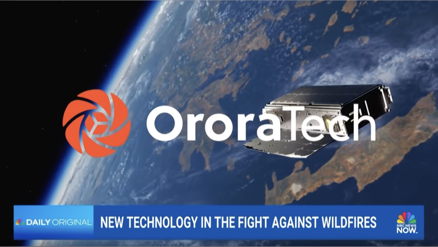
NBC News covers OroraTech's role in the new fire tech landscape
Find a reseller in your region

Albania
How to buy in your region Albania

Biomedika

Angola
How to buy in your region Angola

Optimum Geomatics

Austria
How to buy in your region Austria
Rosenbauer International AG (Austria)

GAF

Bosnia-Herzegovina
How to buy in your region Bosnia-Herzegovina
Biomedika

Mipex Auto RS doo

Botswana
How to buy in your region Botswana
Optimum Geomatics

Brazil
How to buy in your region Brazil

AMS Kepler

Tecnomapas

Brunei
How to buy in your region Brunei

AECA Solutions

Bulgaria
How to buy in your region Bulgaria
Biomedika

Sfera Technologies

Canada
How to buy in your region Canada

Whitestone Industry Services LTD

Chile
How to buy in your region Chile

Latincom

Colombia
How to buy in your region Colombia

GeoSpatial SAS

Croatia
How to buy in your region Croatia

New Age Solutions

Cyprus
How to buy in your region Cyprus

Fireline

Dominican Republic
How to buy in your region Dominican Republic

Paladius - Industrial Fire Products Corp.

Eswatini
How to buy in your region Eswatini
Optimum Geomatics

Ethiopia
How to buy in your region Ethiopia

Rada 360

France
How to buy in your region France
Rosenbauer France SARL

Germany
How to buy in your region Germany
GAF
Rosenbauer Deutschland GmbH

India
How to buy in your region India

ROTER Group

Indonesia
How to buy in your region Indonesia

WGS 84 - Widjaya Global Services

Italy
How to buy in your region Italy
Rosenbauer Italia S.r.l.

Minter Group

Kenya
How to buy in your region Kenya
Rada 360

Kosovo
How to buy in your region Kosovo
Biomedika

Madagascar
How to buy in your region Madagascar
Optimum Geomatics

Malaysia
How to buy in your region Malaysia
AECA Solutions

Malta
How to buy in your region Malta
Minter Group

Montenegro
How to buy in your region Montenegro
Biomedika
Mipex Auto RS doo

Mozambique
How to buy in your region Mozambique
Optimum Geomatics

Namibia
How to buy in your region Namibia
Optimum Geomatics

North Macedonia
How to buy in your region North Macedonia
Biomedika

Pacific Community
How to buy in your region Pacific Community

Drone Service Fiji

Peru
How to buy in your region Peru

Geomatica Solutions

Poland
How to buy in your region Poland
Rosenbauer Polska Sp. z o.o.

Puerto Rico
How to buy in your region Puerto Rico
Paladius - Industrial Fire Products Corp.

Romania
How to buy in your region Romania

Data Flow Pipe

San Marino
How to buy in your region San Marino
Minter Group

Saudi Arabia
How to buy in your region Saudi Arabia
Rosenbauer Saudi Arabia Ltd.

Sadeem Technology

Serbia
How to buy in your region Serbia
Biomedika
Mipex Auto RS doo

Singapore
How to buy in your region Singapore
AECA Solutions

Slovakia
How to buy in your region Slovakia
New Age Solutions

Slovenia
How to buy in your region Slovenia
New Age Solutions

South Africa
How to buy in your region South Africa
Rosenbauer South Africa (Pty.) Ltd.
Optimum Geomatics

Switzerland
How to buy in your region Switzerland
GAF
Minter Group
Rosenbauer Schweiz AG

Tanzania
How to buy in your region Tanzania
Rada 360

Thailand
How to buy in your region Thailand
AECA Solutions

GeoSatPlus

Uganda
How to buy in your region Uganda
Rada 360

United Kingdom
How to buy in your region United Kingdom
Rosenbauer UK Ltd.

United States
How to buy in your region United States
Rosenbauer America LLC.
Team Wildfire
Santa Clara County FireSafe Council

United States Virgin Islands
How to buy in your region United States Virgin Islands
Paladius - Industrial Fire Products Corp.

Vatican
How to buy in your region Vatican
Minter Group

Zambia
How to buy in your region Zambia
Optimum Geomatics

Zimbabwe
How to buy in your region Zimbabwe