Introducing Fire Break Simulation for Smarter Wildfire Containment
Wildfire response is a race against time, and knowing where a fire will spread is only part of the equation. Just as critical is understanding how strategic interventions can alter that path and help contain the threat.
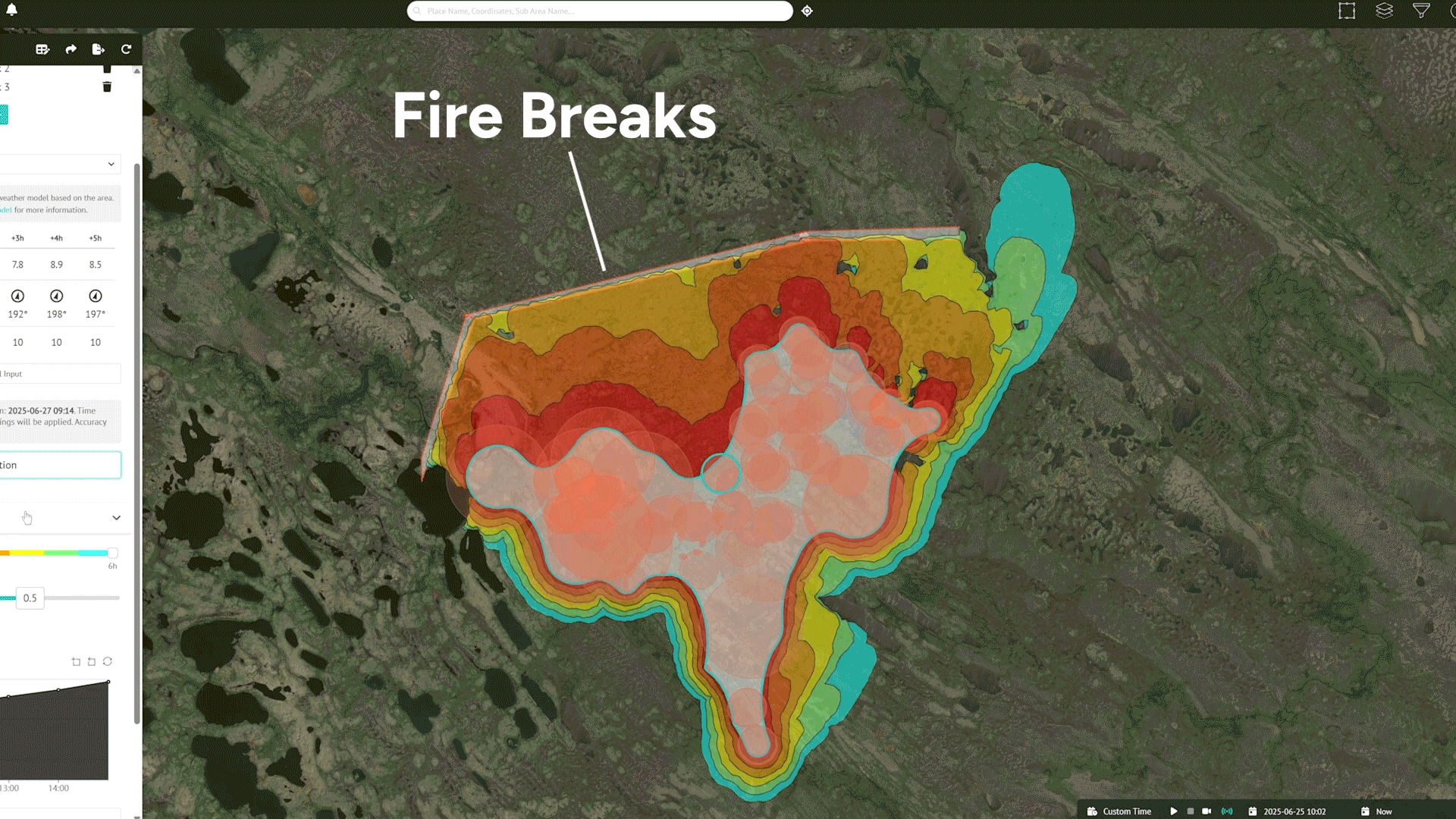
That’s why we’ve introduced a powerful new feature to our Fire Spread tool: Fire Breaks. This enhancement lets users simulate containment strategies directly within the fire spread prediction by adding fire breaks to the map with just a few clicks.
Now, decision-makers can test multiple configurations, assess potential impact, and refine their containment planning in real time. The result? Smarter, faster wildfire deployments based on real-world fire conditions and weather, leading to more targeted, effective mitigation.
What are fire breaks in the real world?
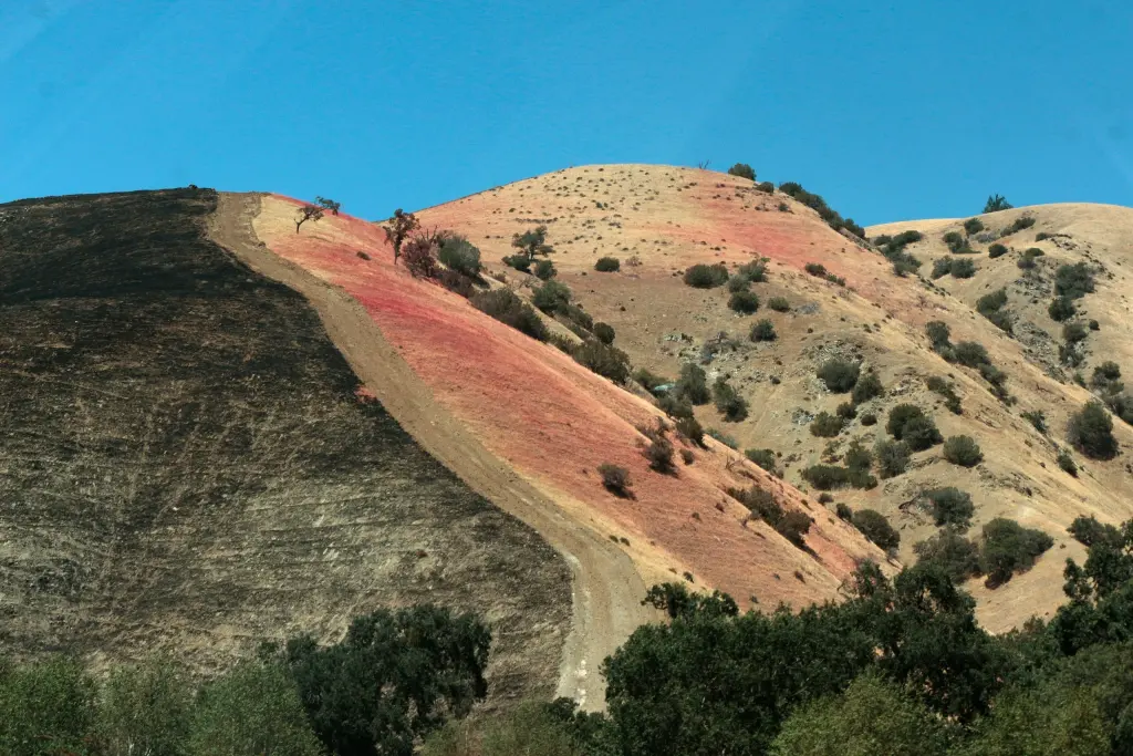
A “fire break”, also known as a “fireline”, “fire road”, or “fire trail,” is one of the most fundamental and widely used tactics for wildfire containment. These defensive barriers are created by wildland firefighters to stop or slow the spread of flames by removing vegetation and other combustible material, effectively depriving the fire of fuel.
Often, fire breaks are carved manually or with machinery, digging down to the mineral soil to ensure no residual fuel remains. Another tactic, known as ‘backburning’, involves setting a controlled fire to burn vegetation ahead of the main blaze, creating a buffer zone that limits further spread.
These sorts of breaks can occur “naturally” too, with defensible positions behind rivers, roads, or canyons. While fire breaks come in many forms, their core purpose is always the same: to contain the fire within a specific line or perimeter.
These zones give firefighters the first opportunity to take control by establishing containment lines and managing any sparks or flames that cross the gap. While not foolproof, fire breaks represent areas where fire is unlikely to cross, thanks to the focused allocation of resources and personnel to maintain the line.
What is the Fire Break feature, and how does it correlate with real-life fire breaks?
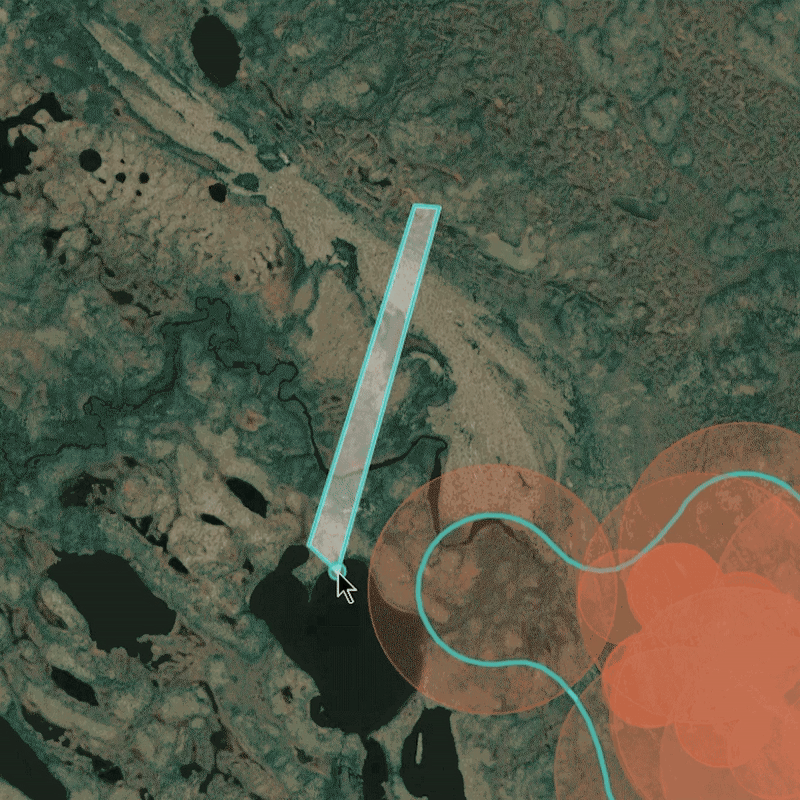
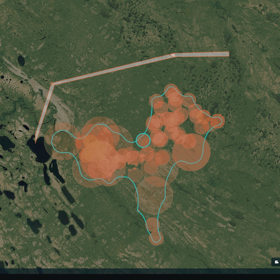
Being able to draw fire breaks directly into our Fire Spread tool means you can view simulations that reflect real-world defensible positions, changing the outcome of a simulated fire event. It also allows you to experiment with different fire break scenarios before sending teams into the field, helping assess how different placements could influence containment. With our tool, you can run variations of containment plans within seconds.
You can add a break by either drawing it directly on the map or uploading polygons from other mapping programs. Once the simulation is complete, the results can be saved and compared with multiple other spread scenarios, all within a single panel.
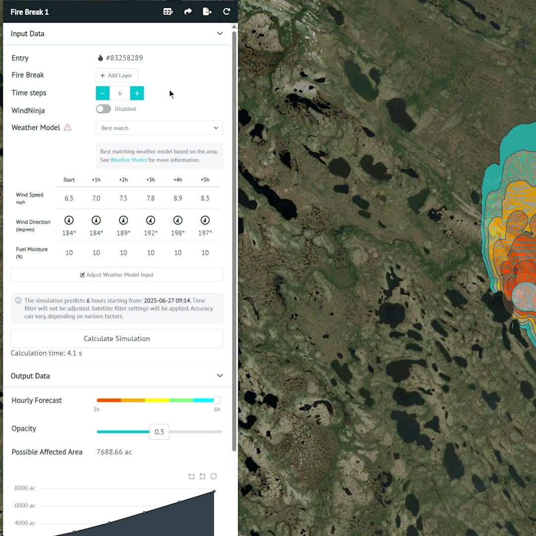
How to set up a Fire Break within the Fire Spread tool
Step 1
Open the Fire Spread panel while a fire is selected.

Step 2
In the section marked “Fire Breaks”, click on “Add Layer.”
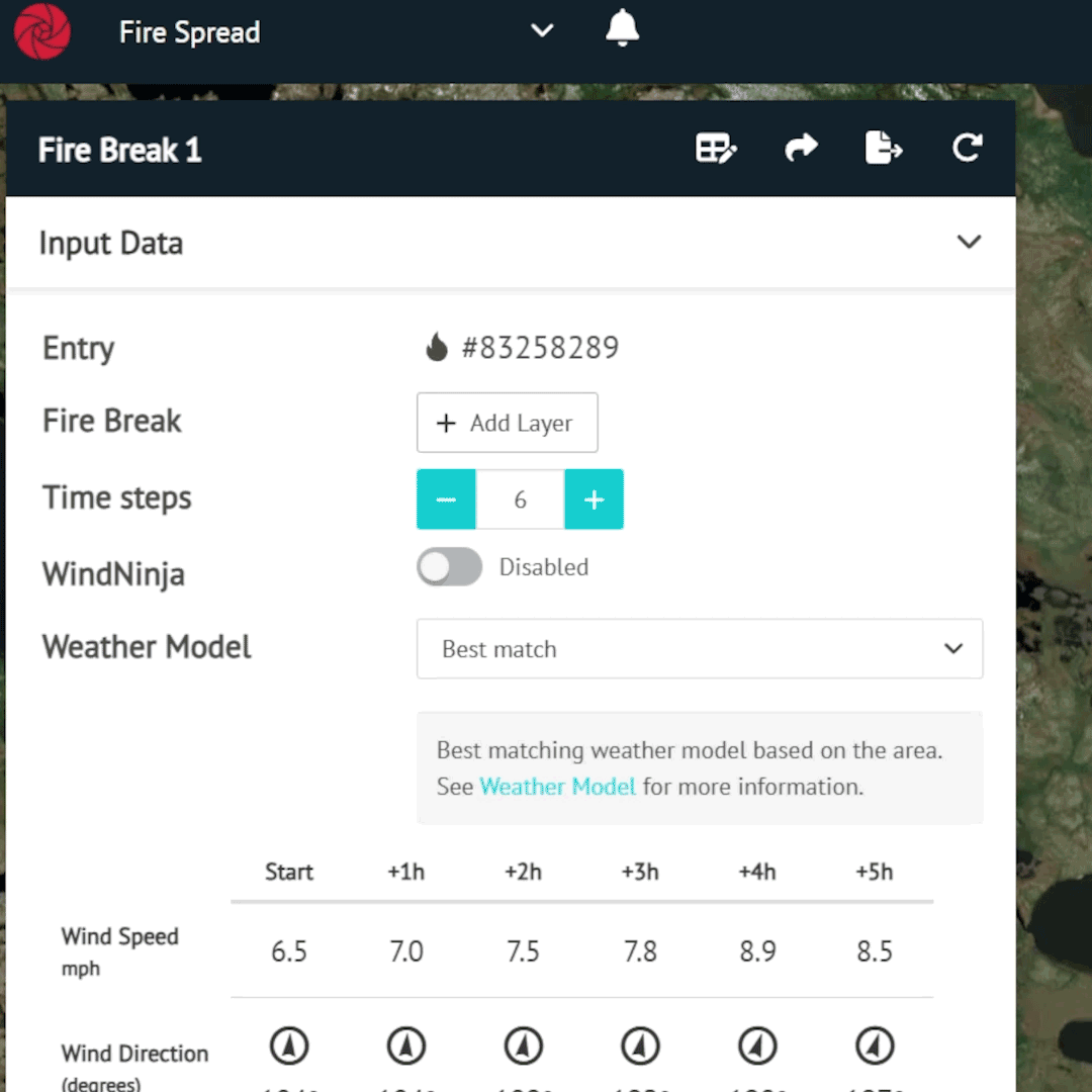
Step 3
Draw the Fire Break directly on the map or upload a polygon. To add additional Fire Breaks, click “Add Layer” and draw another polygon.
Step 4
Run the simulation.
Step 5
After the simulation, you can choose to save the fire breaks for future simulations or delete them if they’re no longer needed.
How does this improve Fire Spread accuracy?
Incorporating Fire Breaks into our Fire Spread tool significantly enhances the realism and precision of our behavior simulations. By introducing areas where fire is unlikely to spread or being actively contained, the tool produces projections that better reflect real-world scenarios.
It also enables commanders to simulate potential containment strategies on the fly. Instead of relying on abstract models or outdated assumptions, wildfire practitioners can now generate fire movement forecasts that account for their actual assets, mitigation teams, and up-to-date fire intensity data from satellite detections. This gives firefighters a data-driven foundation for making critical decisions, whether deploying resources or initiating evacuations in threatened areas.
Conclusion
The goal of this feature is to bridge the gap between simulation and real-world wildfire response. By allowing responders to input realistic containment strategies directly into the model, we enable a fast, iterative planning process that helps test and identify the most effective options.
With tools like this, we aim to support firefighters in making the right decisions at the right time, powered by continuously updated wildfire intelligence with every satellite overpass.
See how Fire Spread can support your wildfire response: